GALLERY / ODDS & ENDS

Maps that didn't
need a full write-up.

Smaller pieces of analysis and one-off maps that didn't grow into a full case study, from accessibility models to commuting flows and terrain. Each one still made something clearer.

2024–2026 UK & INTERNATIONAL ◆ 5 pieces
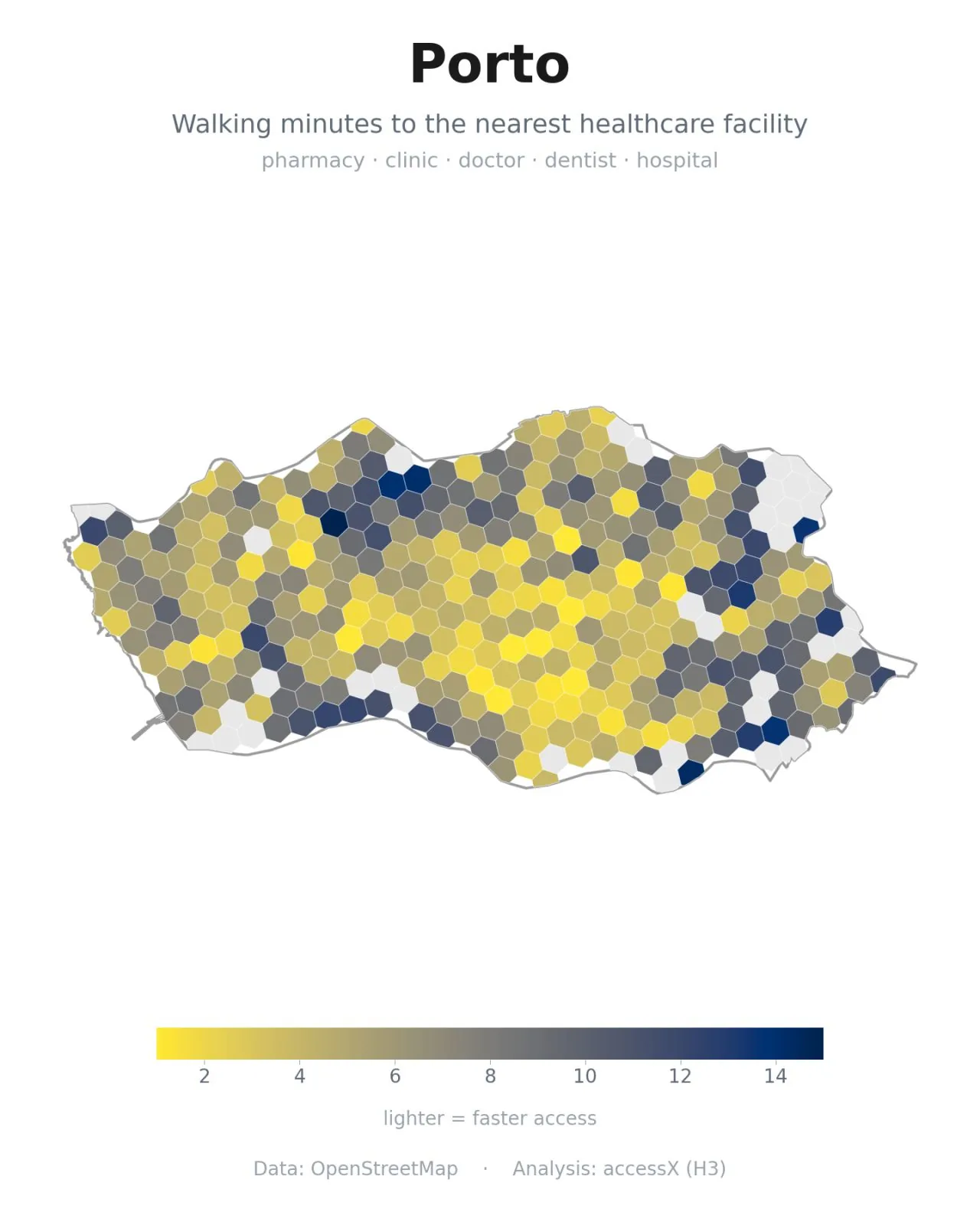
HEALTHCARE ACCESS Hex map of walking time to the nearest healthcare facility across Porto
Porto
Hex by hex walking time to the nearest pharmacy, clinic, or hospital.
HEALTHCARE ACCESS Hex map of walking time to the nearest healthcare facility across Luxembourg
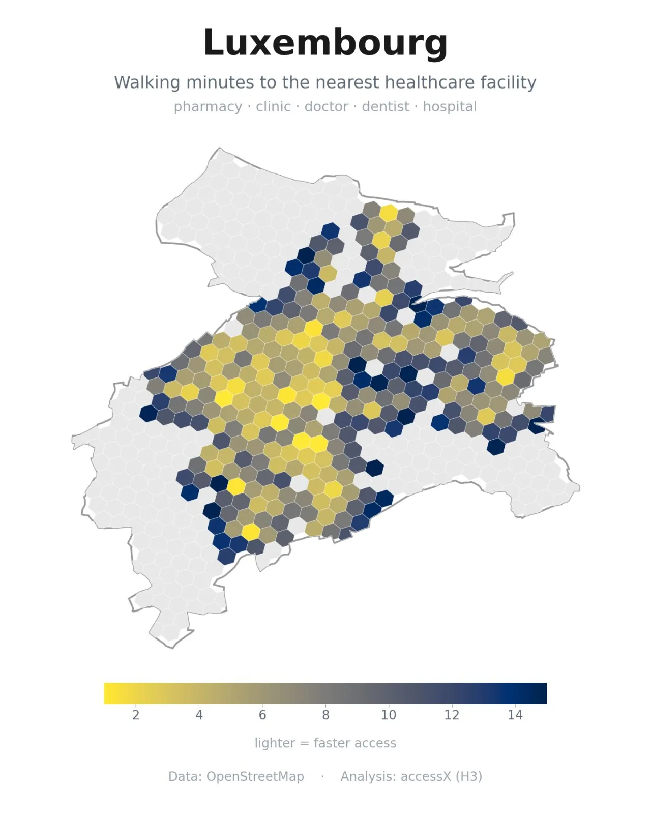
Luxembourg
The same healthcare-access model, showing a sharp gap across the north.
HEALTHCARE ACCESS Hex map of walking time to the nearest healthcare facility across Beirut
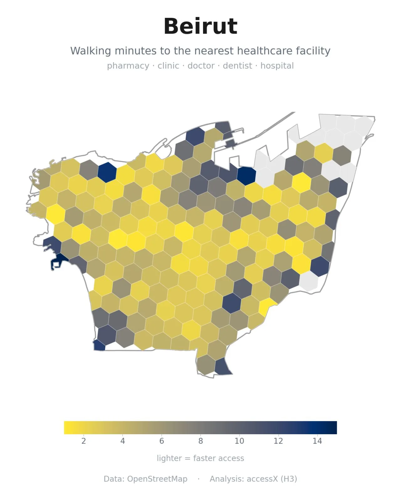
Beirut
Healthcare access mapped hex by hex across the city.
COMMUTING · ONS Map of commuting trips into the London Borough of Havering, ONS 2023 data
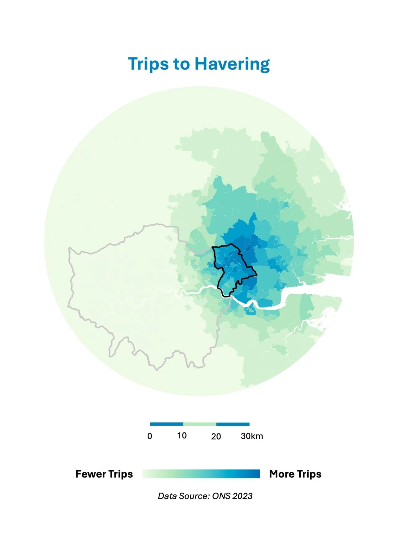
Trips to Havering
Where journeys into the borough originate, built from ONS 2023 travel data.
COMMUTING · ONS Map of commuting trips out of the London Borough of Havering, ONS 2023 data
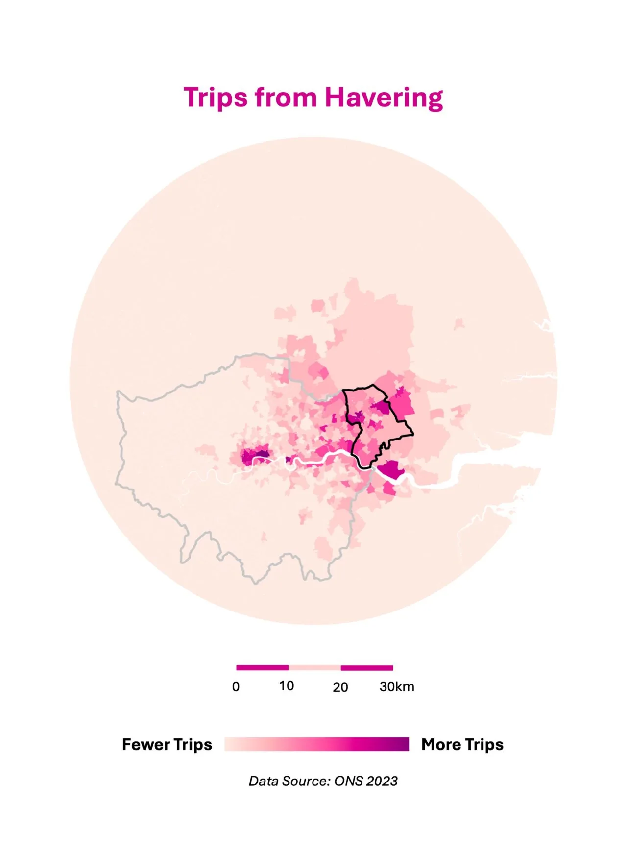
Trips from Havering
The same dataset read in reverse: where outbound journeys end up.
SPATIALLY AWARE LTD · REGISTERED IN ENGLAND & WALES, NO. 17407294 · PRIVACY POLICY · “SPATIALLY AWARE” NAME BY LARA HARFOUCH